| Description | Price | Comments |
|---|---|---|
| Raspberry Pi Zero 2W | $15 | Running Gentoo Linux |
| Decibel Module | $25 [+ shipping] | PCB Artists, India, 4 week shipping time, for 6 models had a shipping cost of $9.00 |
| Official Raspberry Pi Power Supply | $8 [+ shipping] | Official Raspberry Pi product. Plug for 120 has square footprint making it more likely to fit within an outdoor covered electric box |
| Case | To be deteremined. Considerations: bugs |
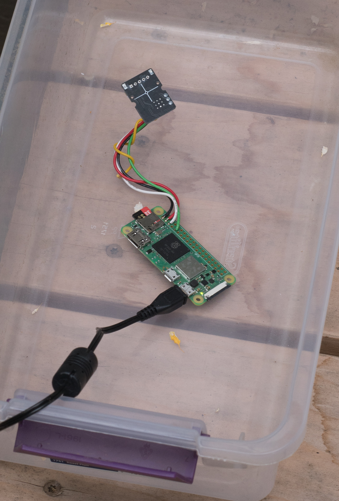
Here's a photo of the Raspberry Pi Zero 2W with a Decibel Module affixed. The unit is in a plastic shoe box sitting outside to capture ambient noise. Only outside during dry weather. 24 solid wires were soldered to the Rpi Zero's board and terminated with a JST-XH male connector.
Decibel data is captured in a shell which polls the decibel module every second and then the value returned is saved in a file with an epoch time value so every second of the day has a decibel value. As aircraft approach, the decibel values rise from the 40s to the 60s and 70s and then lower as the aircraft moves farther away.
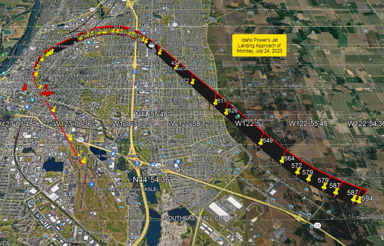
Aircraft is tracked using adsb both in 1090 and 978 [older standard still used by planes not exceeding 18,000 feet] hertz. The capture consists of an antenna links to a transciever with an optional filter (because I am located near a cell phone tower, interference from the cell phone antennas is possible) and fed into a Raspbery Pi 4B. The software currently used is from adbsxchange.com. The transceiver provides raw data feeds on ports and I capture all the raw data and save to a file. A 24 hour capture is over 1 GB of data. With the data, I can recontruct the position of an aircraft at any given second (except for when my antenna does not capture transmissions due to blockage of line-of-sight between the antenna and aircrfat, most often caused by nearby tall trees). In Google Earth, I can recreate the path of the aircraft three dimensions: longitude, latitude and altitude.
Here's an example of a recreation of a flight path:
Last modified: Tuesday, August 22, 2023 5:02 p.m. PST